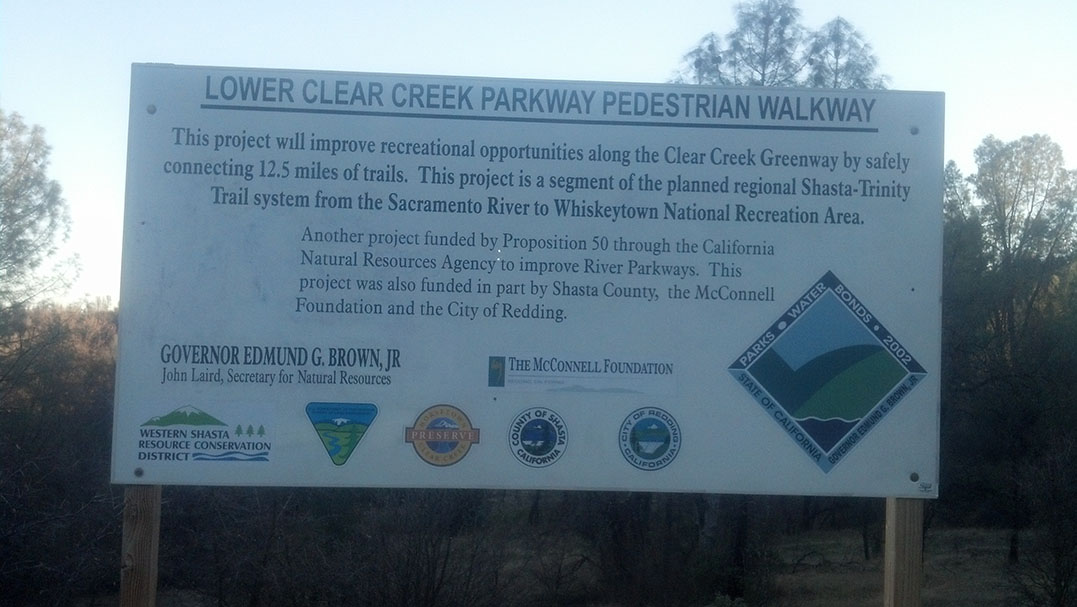
Won’t this be great when it is done? It looks like this section of trails with be 12.5 miles, however the overall plan is great! Right now, all they need added is a trail between the Cloverdale Trailhead up to the Oak Knoll Trailhead on Muletown Road or the Placer Connector Trail in that same area. If that connection is made you can go from the Clear Creek Trails all the way to Whiskeytown. Although I imagine they will have issues when it comes to crossing Clear Creek on Placer at the Veteran’s Memorial Bridge, it’s not really built for pedestrians.
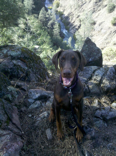
I spend a lot of time out on these trails so I thought I would share some sites you can’t see from the road.
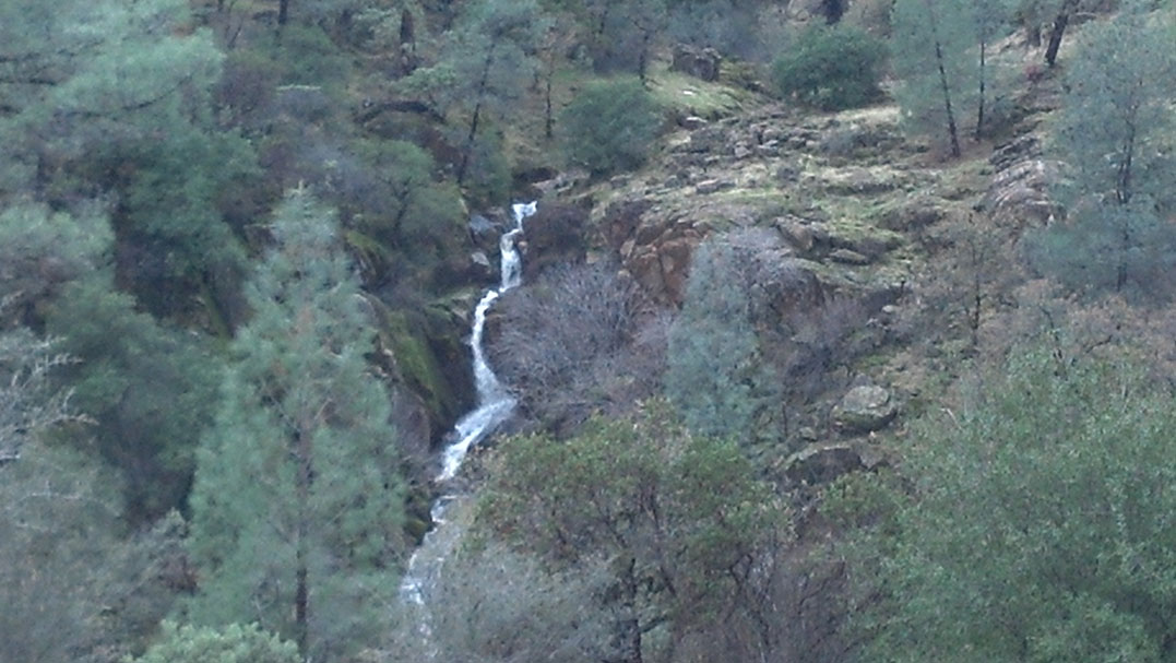
This is a waterfall found on the Piety Hill Loop. It can only be seen after we have had a really good rainfall when all the seasonal creeks are flowing, so you probably won’t be able to see it this year. To see this fall you would want to park at the Horsetown trailhead, head across the street. The entrance to trail is right at the end of the bridge next to the Horsetown Clear Creek Preserve sign. You head up the steep hill until you come to an intersection. If you go left you will head clockwise on the Piety Hill Loop, however go straight (counter-clockwise). When you head straight it will take you down a hill, when you start heading down just look straight and slightly to the left out across the gully, you should see this waterfall if it is flowing.
If you continue down the trail, you will go up another hill, then when you start heading down again you will come to that seasonal creek that makes up the falls. If the water is really flowing you may need to get wet to cross it, otherwise if it is barely flowing you can usually step on rocks to keep dry (Hey BLM how about you put in really big rocks, a culvert or bridge? Pretty Please!). Continuing on if you go straight at the next intersection you can follow the seasonal creek all the way up and see little falls along the way.
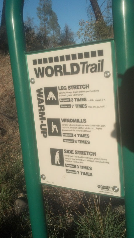
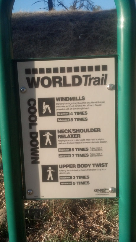
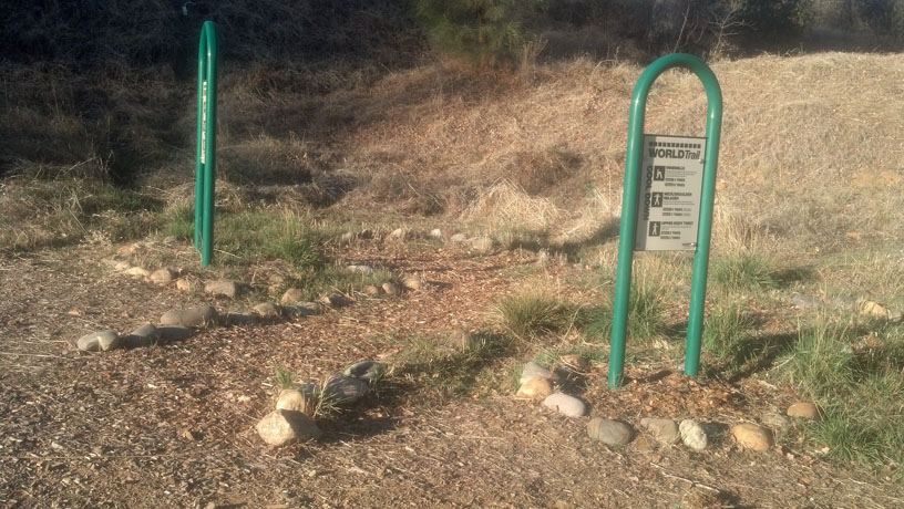
Here is a little secret about the Clear Creek Trails (at least I can’t find any info on it). If you go to the “Clear Creek Gorge Overlook” trail head and go north on the trail (left from the parking lot) you will hit a series of fitness stations spread out over approx 2 miles. These stations are labeled World Trail and they all are for getting you humans fit. Although up pups can’t use the stations it sure is fun watching you humans try. But honestly us pups just enjoy getting out and the bonus is the trail has lots of access to Clear Creek for taking a dip in the summer.
List of the stations
Warm Up/Cool Down
Isometric Squat
Balance Beam
Step Up Routine
Climbing Wall (not like a rock climbing wall you see in a gym)
Leg Lift
Vault Bar
Inclined Body Curl
Chin Up
Parallel Bars
Jump N Touch
Beam Jump
Push Up
Horizontal Ladder
Hip Rotation
Sit Up
This map was done by my mom back in 2010 it show the different stops, some of the point indicate different turnoffs to the creek or trail heads however you can get an idea of how far apart they are.
World Trail Intro Sign
World Trail Warmup Directions
World Trail Cooldown Directions
The 1st station, the others have obstacles or sorts in them
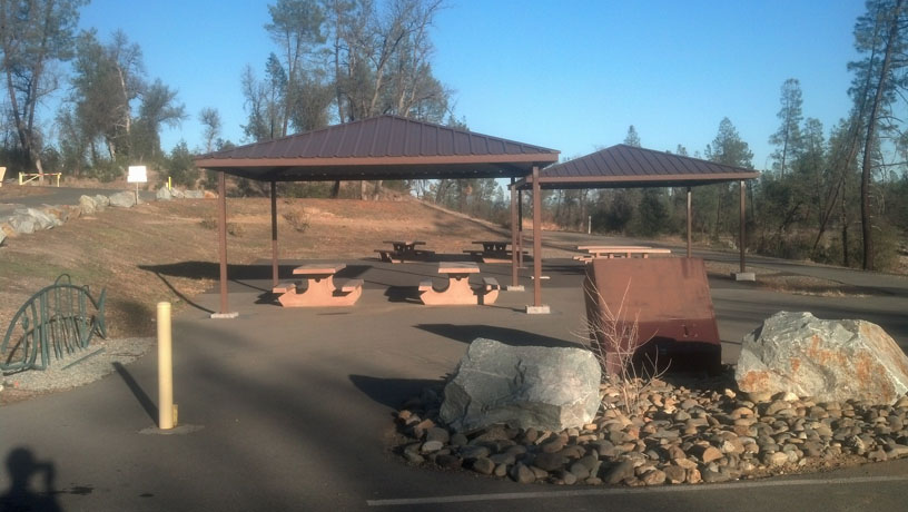
Beautiful Clear Creek Gorge Picnic Area
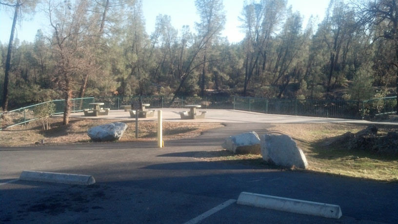
Clear Creek Gorge, the overlook for the salmon spawning area
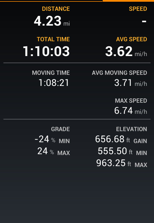
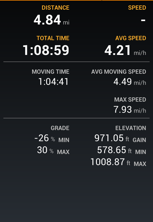
You humans are so SLOW! Mom let me carry the cell phone in my backpack and turned on the GPS. You won’t see much of a difference in the map when you compare it to my human Mom’s GPS track because it’s a 4 mile track and I am good about staying on the trail, but check out the amount of time I have to spend stopped waiting for my Mom! Come on now humans, you really need to learn to use those front lets you call “arms” maybe it will help you move faster!
Take in mind these are 2 different days but same route, also on Mom’s track we had to stop for horses and other dogs but on my track we only had to stop for water.
Let’s start off with showing my favorite trails here in Shasta County (California). I LOVE the Clear Creek trails, these trails are on BLM land and since they aren’t in the city limits they allow off-leash. Here is a link to the BLM page if you scroll down to “Clear Creek Greenway” you can get information including maps. If you have ever been these trails, share your barks with me!
If dirt trails are not your thing or these are too far, Shasta County has a bark-load of trails. You can find most of these trails listed here on Healthy Shasta’s Website. I will try to review more of these trails in the future.
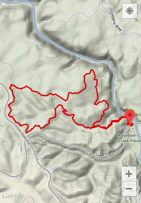
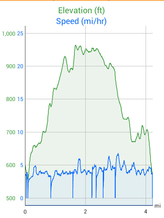
Here are some screen shots of one of our recent hike. This particular hike was on the Piety Hill Loop, but we started at the Horsetown trailhead and did a modified loop. Doing the trail this particular way has so many hills it turns into a bum-barker, you will be feeling this hike if you are not used to hills.
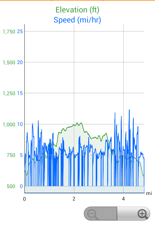
Elevation and speed chart of our hike, it shows a couple times we had to stop for fellow hikers and riders.
Map of our hike
Stats on our hike
Hiking the Piety Hill Loop
Excuse the poor photo quality, the camera on the phone is having issues.